aerial views of the canal and packhorse bridge

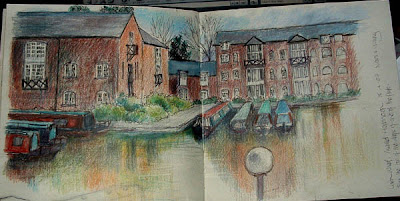
I have just discovered http://maps.live.com - it's amazing! the 3D views are much better than they look here in reality but I had to take photos of the screen as it isn't possible (as far as I can see) to save them or link to them. They show the canal, the River Byam coming in to join it, the canal bridge, modern footbridge carrying the path that goes for miles alongside the river/canal and the old packhorse bridge stretching out across the fields. This microsoft site is much better than the google version and if you live in an area (I do) where you can zoom in on your house - well Big Brother really is watching you! You can see garden tables and patios, the ivy up the end wall and wall in the front garden - the back of my house is rather hidden by trees - the detail is fantastic and you can look from the north, south, east and west. I don't know it this will work but I found out where to link :) this should link to the aerial view of frog island, where the charcoal sket...


